Connecting GIS, asset and hydraulic modelling in the UK water industry
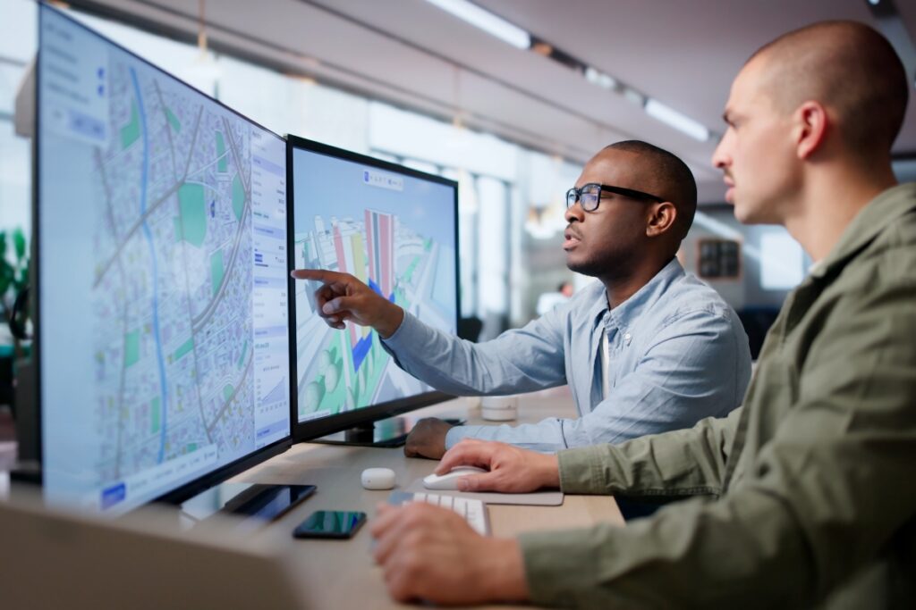
Water companies hold important network information across GIS, asset management systems, hydraulic models, monitoring platforms and spreadsheets. Connecting these systems allows information to move between them as part of a repeatable engineering process, rather than relying on repeated manual transfers. This can help modelling and planning teams keep information aligned, keep current asset and spatial data within modelling processes, analyse network performance at scale and create a clearer evidence trail from network data through to proposed intervention.
This matters increasingly as water companies manage AMP8 delivery alongside statutory Drainage and Wastewater Management Plans (DWMPs), growth, resilience and environmental programmes. Keeping those models and data aligned therefore becomes increasingly important as the same information is reused across different planning activities.
The value of GIS, asset and modelling systems for water companies
Water planning relies on several types of information that describe diafferent aspects of the same physical network. Connecting them allows teams to assess that network using a consistent set of inputs. A typical wastewater planning process may draw on:
| System of data source | What if provides |
| GIS | Asset location and spatial relationships |
| Asset management systems | Asset characteristics, condition, maintenance records and planned interventions |
| Hydraulic models | Predicted network performances |
| Monitoring, telemetry and SCADA data | Evidence of observed network and asset performance |
Current statutory DWMP guidance reflects this combination. Companies are expected to consider asset and performance data, hydraulic and water-quality modelling, monitoring information and future pressures, while key DWMP information is also expected to be made available spatially through GIS portals.
What happens when these systems operate as separate processes?
Separate processes create additional data handling, coordination and quality-control work whenever information changes.
For example, an asset change held in GIS may need to be reflected in the hydraulic model, while growth assumptions or planned schemes may need to be applied through separate calculations before a new set of simulations is run. When this happens repeatedly across many catchments, the data handling itself can become a significant part of the project.
This is particularly relevant to DWMP model maintenance, where processes may involve InfoWorks ICM models, GIS information, Excel logic and Python or Ruby scripts, with outputs from one activity becoming inputs to another. A repeatable workflow can coordinate these components and record the processing undertaken across each catchment.
The benefit is not simply moving data between systems. It is creating a repeatable process that makes it easier to keep models and planning information aligned as the underlying data changes.
The wider direction of the sector also favours better movement of information. Ofwat identifies data, alongside the processes and technology supporting it, as an important water-sector asset and highlights common standards, governance and data infrastructure as foundations for greater use of water data.
What does interoperability mean in water modelling?
Interoperability refers to enabling specialist systems to exchange the information required for a defined engineering or planning process.
The hydraulic model can continue performing hydraulic simulation. GIS can continue managing spatial information. Asset systems can continue holding asset records. An integration layer can coordinate the information passed between them and the sequence in which analyses are completed.
For example, a workflow could take asset and spatial information from GIS, apply agreed planning assumptions, update an InfoWorks ICM model, run the required simulations and pass the results to the next stage of the process. Excel, Python, Ruby and other engineering tools can also be incorporated where they already form part of the organisation’s modelling processes.
This makes it possible to bring existing tools together into a repeatable workflow rather than treating each stage as a separate task. The same process can then be applied across multiple catchments, planning scenarios or model updates, while recording what has been done at each stage.
The approach can also provide a foundation for automation and optimisation. Once the different systems and processes are connected, repetitive modelling activities can be automated and larger numbers of scenarios or intervention combinations can be explored systematically.
How can connected data improve water planning decisions?
Connecting modelling platforms can allow outputs from one type of analysis to become inputs or performance measures for another. This can provide a more complete picture of how proposed interventions affect the network.
For example, a wastewater optimisation might traditionally use metrics such as spill count, spill volume or duration to compare different intervention options. By connecting InfoWorks ICM with a water-quality modelling platform such as MIKE+, water-quality outcomes can also be brought into the analysis.
This means an optimisation can consider not only whether an intervention reduces spills, but also how the resulting changes affect water quality. Water modellers can therefore explore the trade-offs between different interventions using a wider range of performance measures.
This becomes particularly valuable when planning over multiple future conditions. The same connected workflow can apply different growth, climate or environmental assumptions, run the required modelling and bring the results together for comparison. Engineers can then review the results across the different conditions and understand how robust the proposed interventions are.
How does this relate to digital twins?
Integrated GIS, asset, monitoring and modelling information provides some of the foundations needed for a digital-twin.
A digital twin brings together a digital representation of a physical system with data from the real-world. They have potential to flag network performance degradation, predict near future system failures, provide mitigation advice and apply the solution.
For water companies, this could mean bringing together asset information, spatial data, monitoring, telemetry and hydraulic or water-quality modelling to understand how the network is performing and explore how it may respond to future changes.
Interoperability is therefore an important part of the picture. It allows information to move between the systems that already hold these different types of data, so they can be used together rather than remaining in separate processes.
Water companies do not necessarily need to replace their existing systems to move in this direction. Connecting the data and modelling tools they already use can provide a practical foundation for more connected analysis, scenario testing and decision-making.
The important starting point is reliable data, consistent models and clearly defined processes for moving information between them.
Bringing connected water modelling into practice
Connecting GIS, asset information and hydraulic modelling gives water companies a more consistent foundation for repeatable analysis, scenario testing and long-term planning.
HEEDS can connect modelling tools, scripts and data sources within defined workflows, helping teams automate repeatable processes and apply optimisation where it adds value. STRIDE combines HEEDS with water-sector engineering expertise and integration technology to configure these workflows around each organisation’s systems, data and modelling requirements.
This gives water companies a practical route towards more connected modelling processes, with greater consistency, reduced repetitive effort and stronger support for engineering and investment decisions.
Learn how to implement SuDS systems and reduce CSO spills in every catchment. Download A Water Modeller’s Guide to Reducing CSO Spills now.